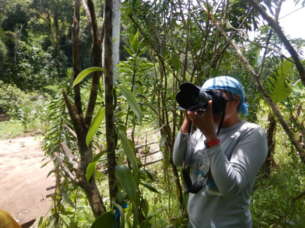
Lovasoa Rakotozafy, a PhD student in Ecology at UZH, used GIS software to prepare her field work in Madagascar. “There are lots of things of which I don’t know how I would have done without the software”, she admits.

Working with a GIS software was not completely new to Lova. When she was a master’s student in Madagascar, she had come across QGIS and ArcGIS, two widespread GIS software packages. “I did a course at that time, but then I didn’t use my skills and I lost them”, she remembers. A few years later while preparing her PhD project, she thought that GIS software could prove beneficial since she is dealing with spatial data: “I assess the conservation role of agroforestry on amphibian in the periphery of the Masoala National Park in Madagascar”, she says, and explains, “the area is a hotspot for amphibians, but at the same time, it has lost a lot of forest to agriculture. Sustainable agroforestry has been promoted as framework to meet the needs of local communities while at the same time reducing deforestation. In my project, I evaluate how effective this form of land use is for the amphibian conservation.”
She initially received data from another project in the same area studying land use change: “The map I received shows over 20 different types of land use in the periphery of Masoala National Park, of which I will only use a handful.” Lova’s focus is on agroforest and forest areas as these are the habitat of the frogs. “My goal is to identify the type of habitat that is the best predictor of frog’s abundance.” Before using the GIS software for her own project, she took a course with Daniel Ursprung, a GIS Hub team member and historian at UZH, with a long history of teaching GIS skills, and learnt the basics of QGIS.
«My expectation for the GIS course was to be able to produce a map showing the coordinates of my fieldwork »

A map for the fieldwork
From the land use data Lova had already determined the size and the shape of the different habitats. “To give some indication regarding the scale, a habitat covers an area of 20 by 50 meters on average.” In the field – or the forest in her case – Lova and her research team will record for each habitat various properties i.e., canopy type, vegetation, number of trees, distance to the closest water source etc. And, most importantly, they will count frogs and determine if there is a gene flow between different habitats.
As the frog’s habitat are scattered in the periphery of the Park and the area shows quite a difference in elevation, Lova determined camp sites using the software to efficiently handle the field work. “From each camp site we will cover a distance of one kilometer, which results in different circles, so called buffers, on the map. We need around 24 days in each circle for the field work, before we can take a break and prepare for the next camp site.”
Map (after) the field work

Looking back, Lova says: “This time I used a GIS software to prepare my fieldwork. So, I will have a map while I am in the field, which is useful.” But often it is the other way around, she continues: “You come back from your field work and have GPS data that you want to show on a map. So, my expectation for the GIS course was to be able to produce such a map showing the distribution of the species across different types of habitat for example.” Although she imagined using a GIS software was easier than it really was, she is still convinced that it is the right tool for her: “I am sure there are other ways to create a map i.e., with R, but I quite like QGIS and will stick to it. Additionally, I will also be able to access my data and maps later when I am back in Madagascar, since it is open source software.”
Lovasoa Rakotozafy is a PhD student in Ecology at the Department of Evolutionary Biology and Environmental Studies at UZH. Her project is in the periphery of Masoala National Park in Madagascar where she studies to what extent agroforestry* systems contribute to the conservation of the amphibian community.
*Agroforestry describes a land use form where trees, shrubs or other woody perennials are grown around or among agricultural crops and/or animals (source: Agroforestry (fao.org)).