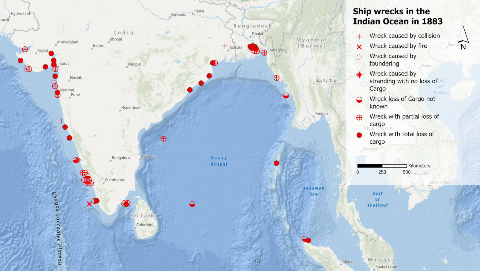
Was können uns Schiffswracks im 19. Jahrhundert im Indischen Ozean über das Klima der Vergangenheit sagen? Und was verraten uns die Aufzeichnungen dieser Wracks darüber, wie Klimawissen generiert wird? Diesen Fragen geht Debjani Bhattacharyya, Professorin für die Geschichte des Anthropozäns am Historischen Seminar der UZH, in ihrer Forschung nach.
Kategorie-Archive: Geodata
Was sagen Volksmusik-Sendungen über uns aus?
Volksmusik-Sendungen sind mehr als nur Unterhaltung. Was sie über die Gesellschaft, Kultur und Heimat aussagen, dem geht ein SNF-Forschungsprojekt nach. Wir vom GIS Hub durften fürs Projekt eine Karte der Sendeorte erstellen.
Comparing two sets of point data (III)
When we count points of two data sets per cell, we can compare their densities. Generating Chi expectation surfaces allows us to compare actual with expected densities. To come back to our geographical names with “wald” in Switzerland, we could compare if these names are over- or underrepresented compared to all the geographical names.
Working with point data (II)
This is part II of the point data tutorial for QGIS. It teaches you how to create a grid to calculate a density surface, that is to count the points per grid cell.
Selecting point data in QGIS (I)
Let’s assume: You have imported point data into QGIS and want to analyse it further. This short tutorial shows you step by step how you can filter your dataset based on an attribute or on the spatial location.
How to start a new project in QGIS?
You have spatial data and know what you want to analyse, but how do you start? This short tutorial gets you started and guides you step by step through a project setup.
Using GIS to tackle the SDGs
How do companies, NGOs and public institutions monitor their progress towards the sustainable development goals (SDGs), and how can GIS software contribute? Five speakers provided answers from different perspectives at the event “Using GIS to tackle the SDGs”, organized by the GIS Hub and ESRI Switzerland.
A new generation of desktop GIS for the Swiss Parks
This summer, the Competence Centre for Geoinformation (CCG) of the Swiss Parks Network, in collaboration with the Department of Geography of the University of Zurich (GIUZ), organised an introductory training course on ArcGIS Pro for employees of the Swiss parks.
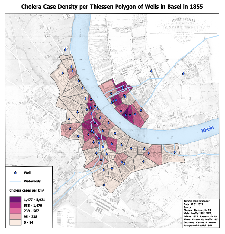
Cholera 1855 in Basel: Zwischen Geschichte, Epidemiologie und geografischer Visualisierung
1854 kartiert der Arzt John Snow die Cholerafälle im Londoner Stadtteil Soho. Er kann so zeigen, dass die Krankheit über verseuchtes Wasser übertragen wird. Was sich heute aus den Cholerazahlen von 1855 in Basel mittels geografischer Visualisierungen herausholen lässt, hat Inga Birkhölzer in ihrer Masterarbeit untersucht.
Von Hintergrundkarten über Zeitreihen bis zu Toiletten-Plättli im Landeskarten-Look
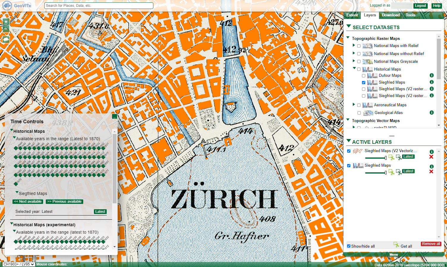
Die Plattform GeoVITe stellt topographische Raster- und Vektorkarten, digitale Höhenmodelle und Orthofotos für die Forschung bereit. Roman Walt, der die Nutzer*innen der Plattform betreut und berät, erklärt im Interview, wie sich die Daten von GeoVITe einsetzen lassen, was der Mehrwert gegenüber den Daten von Swisstopo ist – und er erzählt von der witzigsten Anfrage.


